A. Sides, J. Arand, M. Saunders
Summary
This trial evaluated the effectiveness of using a thermal-imaging drone to detect target invasive predators - specifically ship rats (Rattus rattus) - in coastal and intertidal environments in South Westland. Standard ground-based detection tools (such as AI cameras, trail cameras, and ZIPInns) cannot be placed in these exposed coastal and mudflat zones because they are routinely flooded by high tides and exposed to the harsh west coast swells and winds. Ground searches using conservation dogs are restricted with access conditions and labour-intensive terrain (mudflats).
The trial demonstrated that thermal drone technology is a viable solution for detecting ship rats in coastal and intertidal environments; providing robust detection in areas where otherwise visibility is very limited (e.g., beaches, foreshores, and driftwood margins). However, thermal drone operations are heavily constrained by local weather conditions, water levels, and vegetation cover.
Background and Purpose
Problem Statement: Following rat detections in unexpected locations along the coastline of PFSW it was suspected rats were bypassing detection devices by traveling along exposed tidal edges, mudflats, and beach margins at night where standard detection devices cannot be installed.
Core Question: Can a nocturnal thermal drone identify rats along intertidal and coastal boundaries where standard detection devices cannot be installed?
What We Did
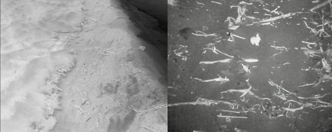
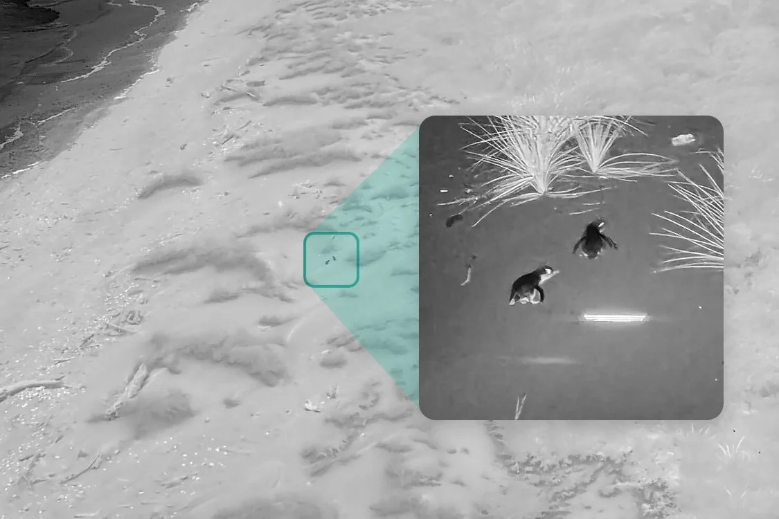
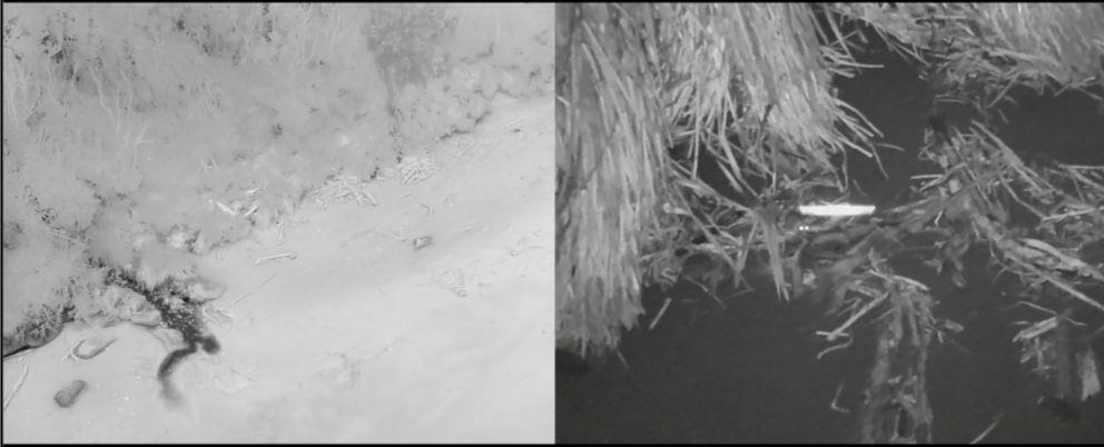
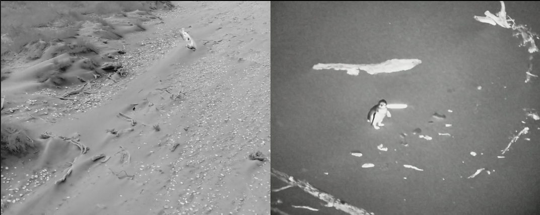
ProVision was contracted in to carry out the drone work. ProVision operated the drone and flew the planned detection lines. A DJI M300 drone was used equipped with a H30T thermal camera with the ability to use infrared which allows us to capture the split images showing the thermal image as well as the infrared image side by side.
Detections were classified by human eye on screen during flight by an experienced pilot. The pilot zoomed in on all targets initially to establish a visual baseline scale, subsequently zooming in only on larger or ambiguous targets to maintain operational efficiency. The footage is also recorded and can be analysed later by specialist.
Rats were distinguished from mice primarily on body size scale. Small individuals were categorized as mice (rather than juvenile rats) because mice are far more common, and dependent juvenile rats rarely forage independently in open areas.
Flights took place over four nights in mid-April 2026 across several coastal sections:
| Date | Target Area | Distance | Weather & Environmental Conditions | Key Detections |
|---|---|---|---|---|
| 13/04/26 | Ōkārito Cliffs & Waiau Bluff / Riverbed | 11.15 km | High tide, light winds, rain showers. Efforts were stopped as it started to hail. | 0 Rats 1 Penguin 3 Rabbits 36 Mice. |
| 14/04/26 | Three Mile & Five Mile Beaches | 36.96 km | Clear after 6:00 PM; high tide at 7:00 PM. Accessed via helicopter earlier in day. | 3 Rats 20 Penguins 1 Rabbit 61 Mice. |
| 15/04/26 | South Ōkārito Lagoon | 0 km | Operations cancelled due to heavy rain and flooded mudflats. | None. |
| 16/04/26 | Ōkārito Spit / North Beach | 33.69 km | Rain early, strong SW winds. Accessed via boat across the lagoon. | 0 Rats 3 Penguins 4 Deer 107 Mice. |
Results
Rat Detections
There were three rat detections, all of which occurred on 14 April 2026; one detection was halfway along Three Mile Beach, and the other two detections were near the southern end of Five Mile Beach.
The three detections all occurred within 1.3 km of known AI camera detections on land, which aligns with the spatial model for rat activity following an initial camera detection used by ZIP.
Non-Target Wildlife Detections
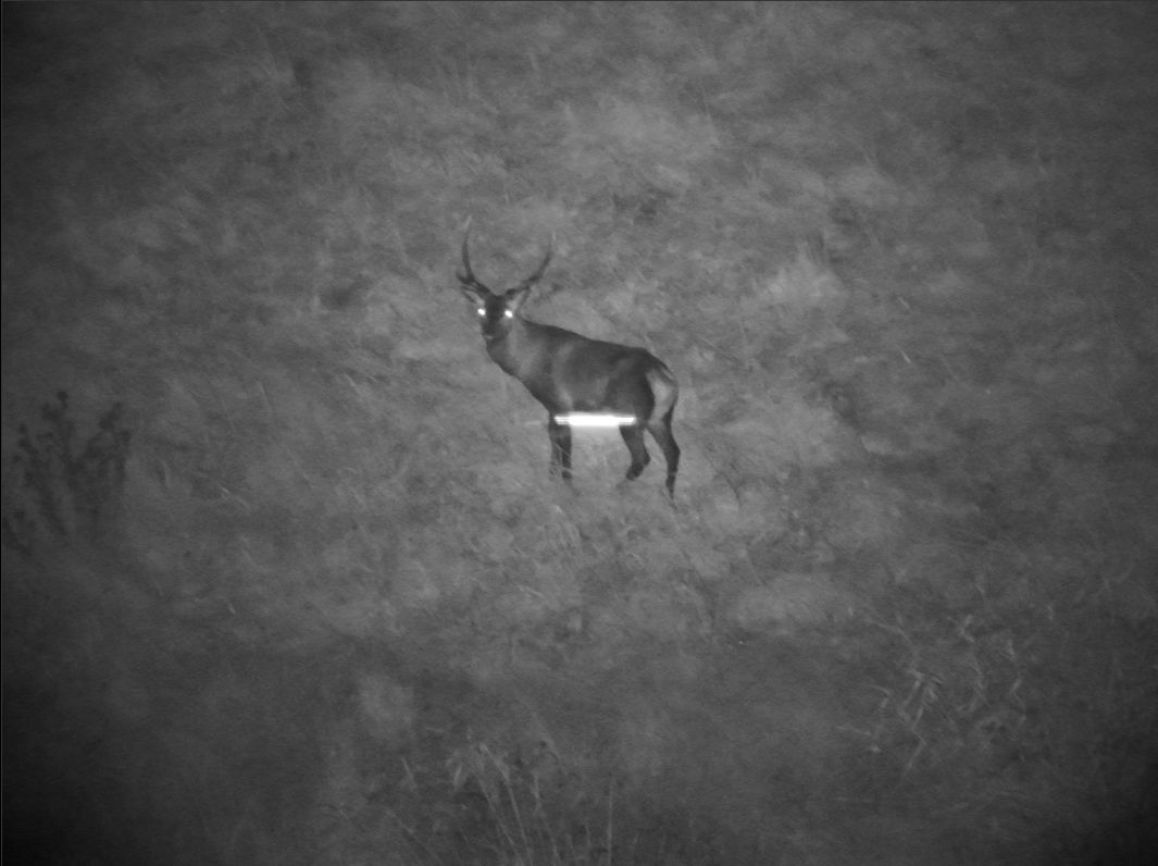
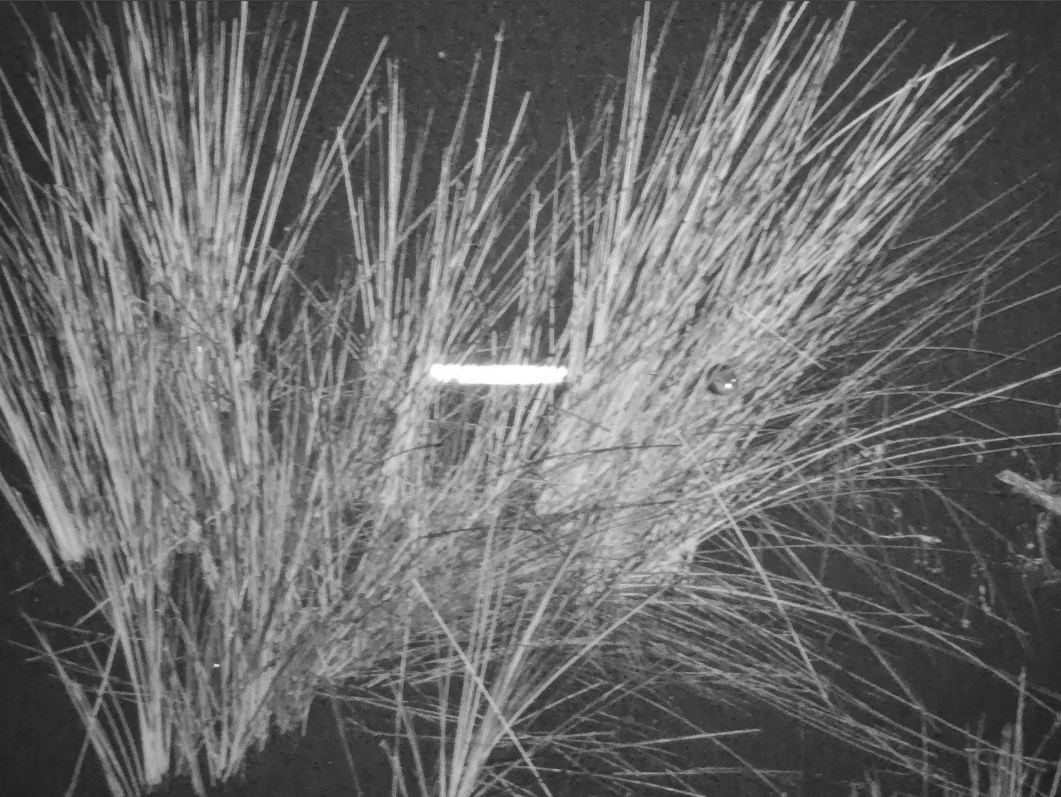
There were 204 mouse detections, which were widespread across beach margins and coastal grass/scrub interfaces. Penguins were detected 24 times, along beach areas and around Three-Mile Lagoon. There were four deer detections, at the lagoon edge on the spit. Rabbits were detected 4 times, along beach sections.
Findings
Successes
Proof of Concept: Confirmed that thermal drones can detect individual rats and other species of interest on open sand, driftwood banks, and intertidal coastal margins.
Access Efficiency: Allowed rapid coverage of over 80 km of coastline at night in challenging terrain without physical ground disturbance.
Operational Challenges and Lessons Learned
Weather Sensitivity: Rain and hail severely disrupt operations and risk damaging drone equipment.
Tide and Hydrology Dependencies: Lagoon mudflats require specific low-tide windows combined with dry weather; heavy rainfall inland keeps lagoon water levels high regardless of low ocean tides, submerging mudflats.
Vegetation Cover: Thermal imagery cannot penetrate thick forest canopy or heavy shrub cover (such as gorse or dense reeds). It is suspected that on windy nights (e.g., 16 April), animals stay sheltered inside vegetation, making them difficult to detect.
Future Directions & Strategic Recommendations
Refined Weather/Tide Timing: Future trials targeting mudflats must evaluate local lagoon water levels and rainfall patterns, rather than relying solely on standard tide charts.
Behavioural Tracking Trials: Evaluate whether rats are foraging on the beach/mudflats or using coastal fringes for long-distance dispersal by watching individual rats and assessing their behaviours in more depth.
Camera Network Placement: Adjust ground-based AI detection camera networks closer to the immediate beach/bush boundary to intercept coastal-moving individuals.
Ability to Pivot Operations: Ensure there are backup search sites (e.g., farmland possum monitoring requiring landowner permissions) to pivot operations when coastal weather prevents flying and make the most of contractor time while on the coast.
Thanks to
Trial implementation and logistics were led by Monty Saunders, Field Ranger, South Westland
Trial design and reporting was led by Andrew Sides, Technical Advisor, Wellington
Drone Operation and Detection was led by ProVision
Appendix 1. Thermal Detection Images
Rat
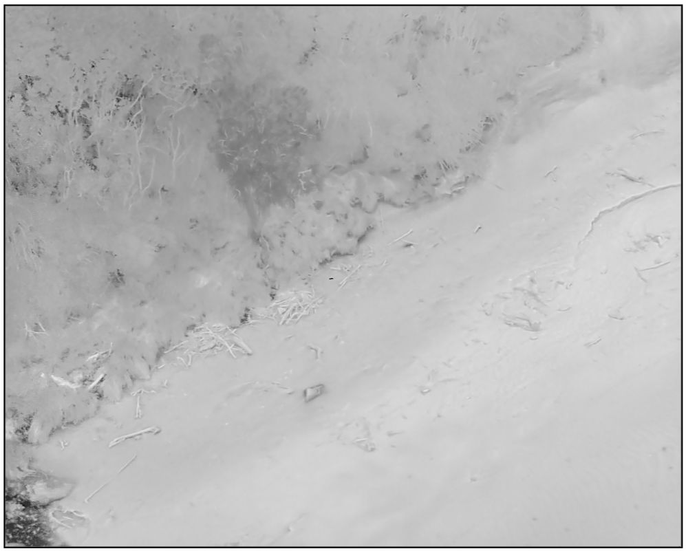
Rat
Penguin
Deer
Mouse
Rabbit